Numina helps cities, developers, and universities manage streets.
Join cities across the globe that measure pedestrian safety, real estate, parks utilization, and urban actuation.
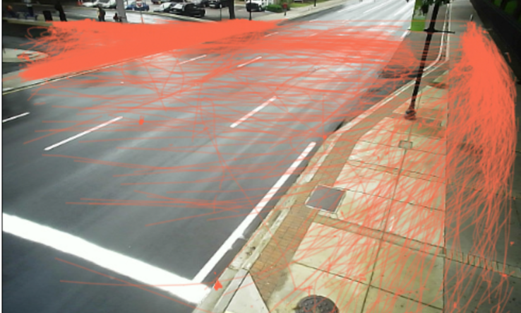
Pedestrian Safety
City of Jacksonville used Numina to baseline pedestrian usage, quantify crash rates, and identify where to locate new mid-block crossings.
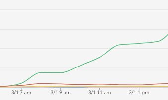
Real Estate
Downtown Brooklyn Partnership used Numina to measure the impact of scaffolding and construction on local businesses.
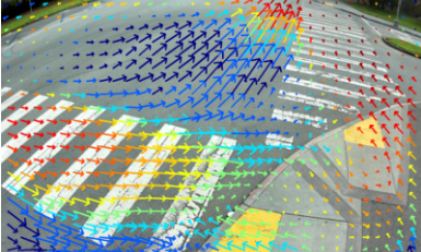
Parks Utilization
The San Francisco Recreation & Parks Department uses Numina in Golden Gate Park to compare visitorship, traffic, and events attendance between open traffic and car-free days.